Overview
Unlock Seamless Network Deployment with Sitetracker GIS Link
Sitetracker GIS Link seamlessly integrates geospatial and deployment data to streamline planning, engineering, and network construction. With real-time collaboration, efficient scheduling, progress tracking, and reporting, your team can rapidly accelerate your deployments. Say goodbye to endless manual processes and swivel-chair data entry. Join industry-leading network operators and contractors who trust Sitetracker for an end-to-end planning and construction solution.
Benefits
Simplify Handoffs
Say goodbye to tedious data transfers between design and construction. Sitetracker GIS Link streamlines the handoff process, ensuring data accuracy and reducing errors.
Increase Efficiency
Boost network deployment efficiency with GIS-powered project workflows that improve how you capture, track, and report construction progress through closeout.
Collaborate Effortlessly
Enable unified workflows between planning, engineering, and construction teams. With Sitetracker GIS Link, everyone can collaborate effortlessly and stay on the same page.

“We’re excited to be among the first to roll out Sitetracker GIS Link! With fiber work continuing to ramp up, GIS-enabled workflows are vital to improving collaboration while reducing inefficiency. Aligning geospatial data with projects is a logical evolution that enables Sitetracker to remain a key and core system in our overall architecture.”
Rob Reynolds
Chief Information Officer and Chief Administrative Officer, Congruex
Explore What GIS Link has to Offer
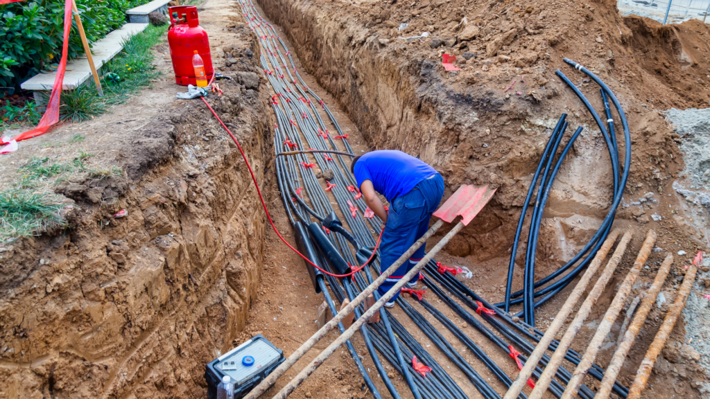
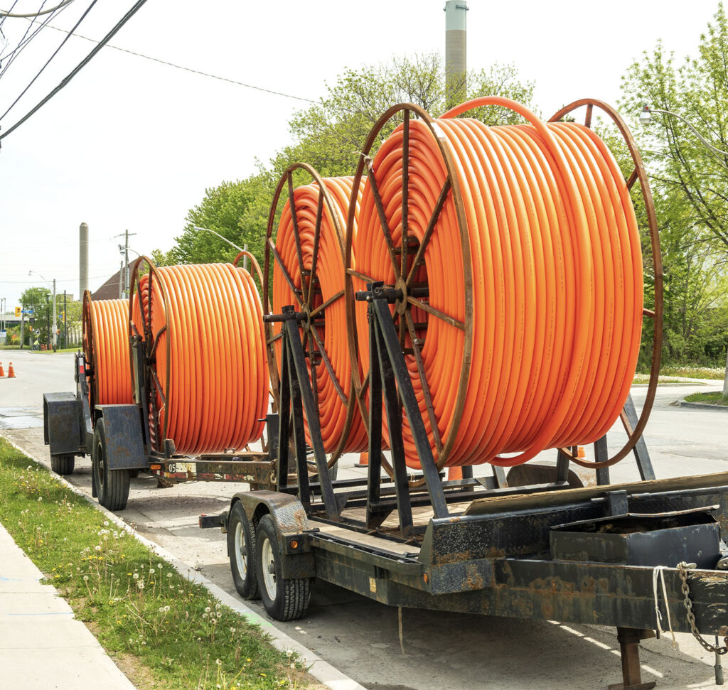
Fiber
Streamline your fiber projects with GIS-enabled workflows, integrating geospatial map layers and reducing duplicate data entry.

Wireless
Consolidate mapping data and centralize external map layers to optimize site evaluation and streamline small cell program rollouts.

EV Charging
Accelerate EV charging projects by integrating geospatial site data, optimizing site selection, and visualizing power demands.

Work more efficiently with teams & data in sync
Align internal and external teams with a unified workflow for sharing geospatial designs
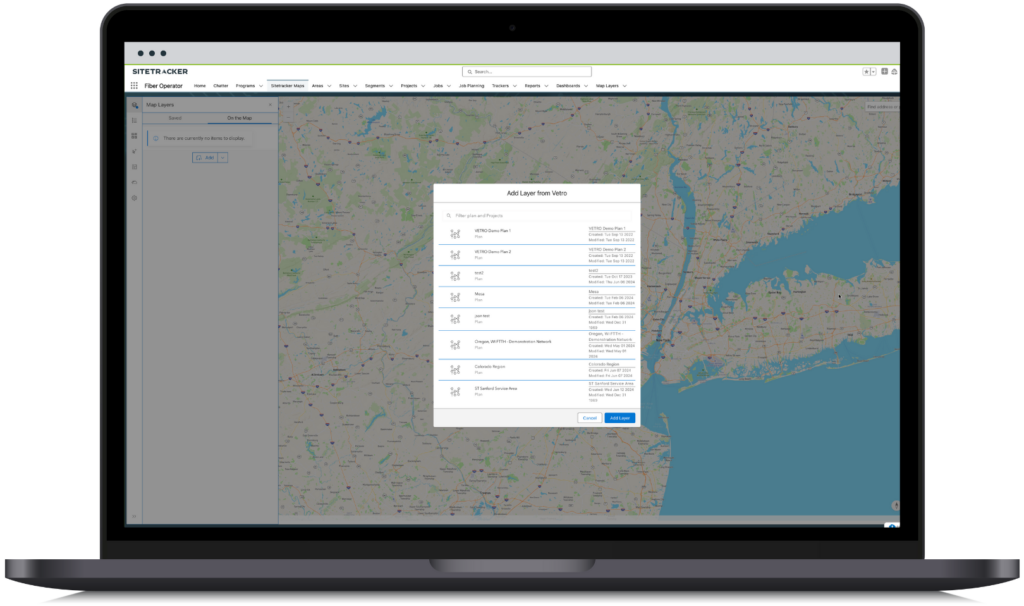
- Easily import GIS network design data from VETRO FiberMap, Esri ArcGIS, or standard file formats like KMZ, SHP, and GeoJSON
- Maintain consistent records and keep data fresh with a bi-directional sync tied to your GIS design
- Confidently handoff designs to internal or external teams
Guide Projects with Geospatial Data
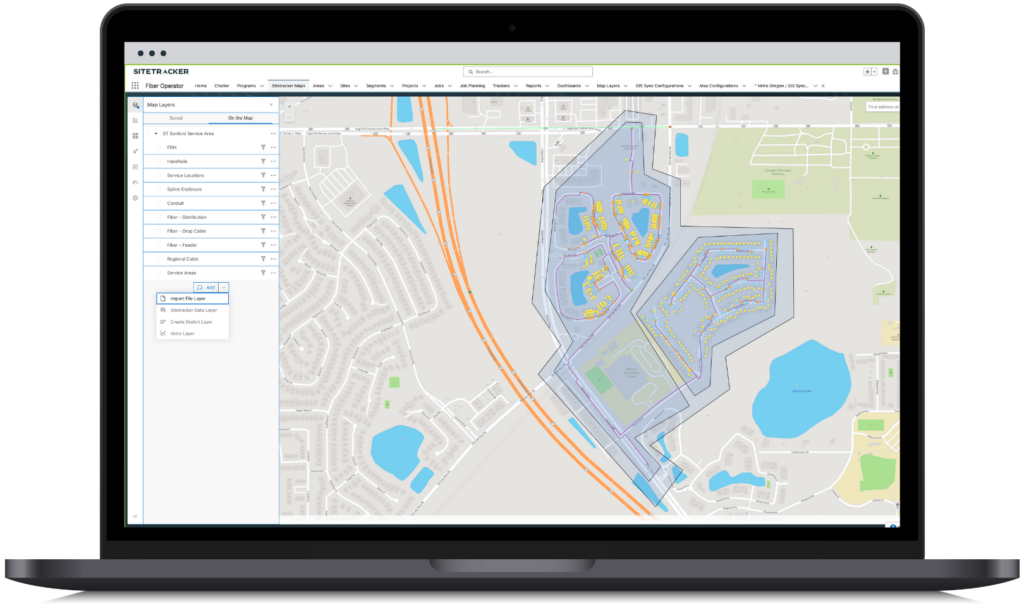
Leverage imported designs to reduce duplicate data entry and streamline the creation of work plans
- Utilize Areas to roll up programs and projects at the market or service area level
- Create and assign construction activities from imported data
- Generate geospatial objects directly in Sitetracker like sites, segments, and polygons
Capture & Share More Accurate Construction Progress
Improve data quality with activities aligned to design and visualize network buildout progress
- Gather fielding data to verify high-level designs and revise cost estimates
- Update records in bulk with embedded Trackers linked to maps
- Sync your GIS design with updates from the field
DEPLOYMENT OPERATIONS MANAGEMENT
Why is Geospatial Data Critical for Deployment Operations?
Globally, critical infrastructure sectors like broadband internet and renewable energy are experiencing a historic, once-in-a-generation influx of public and private investment. But historic funding also brings historic challenges like increased competition and tight labor markets.
To achieve speed to market and meet aggressive build targets profitably, critical infrastructure firms (developers, network operators, asset owners, and contractors) need to shed outdated processes and adopt modern, efficiency-oriented technology solutions. Geospatial insights aligned to project, site, and asset data enable providers to easily manage handoffs between project stakeholders and ensure faster, less costly, and more transparent deployments.
Learn More